Official websites use .gov
A .gov website belongs to an official government organization in the United States.
Secure .gov websites use HTTPS
A lock ( ) or https:// means you’ve safely connected to the .gov website. Share sensitive information only on official, secure websites.

Welcome!
Help the USGS to update USA Structures occupancy classifications in support of FEMA and The National Map. To get started, login and then choose the area to edit below.

Washington, D.C., formally the District of Columbia and commonly known as Washington or D.C., is the capital city and federal district of the United States. The city is on the Potomac River, across from Virginia, and shares land borders with Maryland to its north and east. It was named after George Washington, the first president of the United States. The district is named for Columbia, the female personification of the nation.
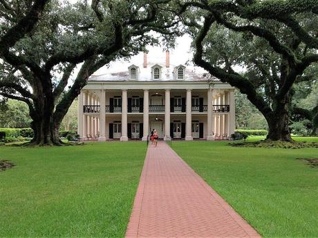
St. James Parish (French: Paroisse de Saint-Jacques) is a parish located in the U.S. state of Louisiana. The parish seat is Convent. The parish was created in 1807. St. James Parish is a part of the New Orleans–Metairie, Louisiana metropolitan statistical area, sitting between New Orleans and Baton Rouge on the Mississippi River. According to the 2020 United States census, the population was 20,192.
Total classifications made
Total buildings verified
Active participants
Mission completion
About
TNMCorps is partnering with FEMA to utilize the power of TNMCorps’ volunteer community to improve AI-generated building classifications in the FEMA USA Structures dataset.
The USA Structures dataset is a collaborative effort between Department of Homeland Security (DHS), Federal Insurance and Mitigation Administration (FIMA), Federal Emergency Management Agency’s (FEMA’s) Response Geospatial Office, Oak Ridge National Laboratory (ORNL), and the U.S. Geological Survey (USGS) to build and maintain the nation’s first comprehensive inventory of all structures larger than 450 square feet for use in flood mitigation, emergency preparedness and response.
Additional information on the USA Structures dataset is available here.
This nationwide dataset of building outlines (structure polygons) and occupancy classifications were generated using existing datasets supplemented by machine learning techniques.
As part of this pilot project, volunteers will review existing assigned building occupancy classifications and update them as needed.